
 Not everyone has the resources or stamina to hike any of our planet’s Seven Summits—the highest mountains on each of Earth’s seven continents—so Google is bringing that experience to the Internet. When famous landmarks and beautiful national parks aren’t enough, the search giant’s Street View technology is making it possible for any old Aunt Sue to explore places like Aconcagua in South America and Everest Base Camp in Asia.
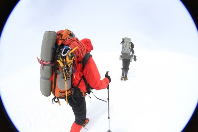
Google managed to capture four of the Seven Summits through the use of lightweight tripods and an unnamed digital camera with a fisheye lens. If you’ve been bitten by the adventure bug but you’re stuck in an office, or you just want to escape for a minute, traveling to some of Earth’s most impressive natural wonders is a nice way to get away.
In addition to announcing the new Street View locations, Google also put up a behind-the-scenes look at how the company made the project happen. “We’re honored to share this amazing imagery with you on Google Maps and show the world what life is like from the its highest peaks!” said Sara Pelosi, People Programs Manager at Google.
If you’re a would-be adventurer or just genuinely curious about what the view is like from Killimanjaro, you can take a peek from your computer, or even your Android or iPhone device.
[Source: TechnoBuffalo]